Whether you run a travel blog, a business directory site, or want to build an online store, interactive maps can make it easier for users to find particular locations. These visual tools can also make your contact page and other content more engaging and interesting. Therefore, you may be looking for the best interactive map plugin for WordPress.
In this post, we’ll take a closer look at interactive map plugins and how they work. Then, we’ll review some of the best options on the market. Let’s get started!
What Are Interactive Map Plugins?
An interactive map is a visual element on your site that can highlight particular locations. For example, if you write a hiking guide on your blog, you can include a map of the trail.
Likewise, if you publish city itineraries, you can use maps to mark must-see attractions, restaurants, and more:
If you have a WordPress site or WooCommerce store, you can use a plugin to display interactive maps on your pages. Depending on the tool you choose, you should be able to integrate your site with Google Maps. (If not, you can check out these top Google Maps Plugins.) Also, most will allow you to create custom maps with your own markers and offer different views of your locations.
Using an interactive map plugin can provide more value to your visitors. It enables readers to locate places and plan their trips more efficiently. Additionally, if your online business has multiple physical store locations, a user-friendly map will make it easier for customers to find and visit your outlets.
6 Best Interactive Map Plugins for WordPress
Now, let’s look at some of the best interactive map plugins for WordPress. We based our selections on several criteria, including features, ease of use, and customization options.
1. Interactive Geo Maps

As the name suggests, Interactive Geo Maps enables you to create interactive maps of continents and the world. You can also display country maps and highlight different regions.
Key Features for Interactive Geo Maps:
- Add colored markers to your maps.
- Choose from different map projections, including Mercator and Miller.
- Exclude specific regions from the map.
- Set click actions and hover color change settings.
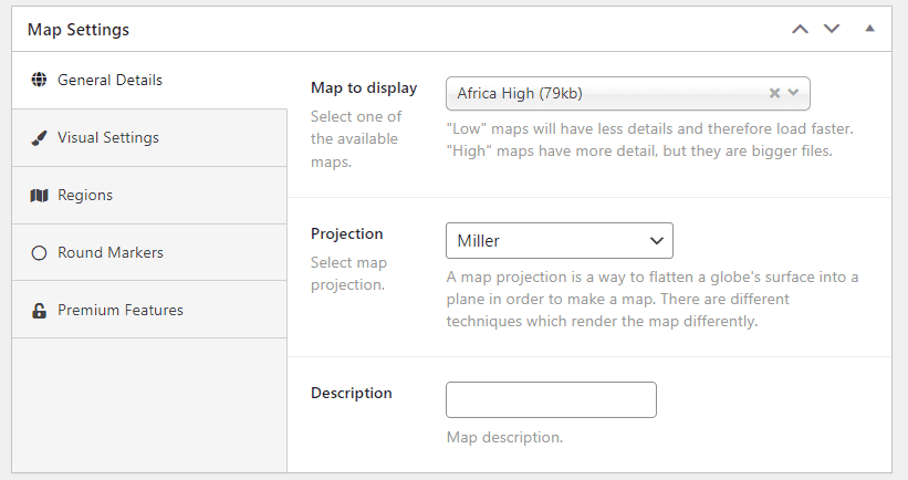
This plugin comes with a user-friendly interface. You can start by selecting the region you wish to display, then customize the appearance of your map from the visual settings. You can also add round colored markers to pinpoint specific locations.
Interactive Geo Maps is for you if…
- You have a travel website and want to display interactive maps of different countries.
- You run an international business and want to show the countries you operate in.
Interactive Geo Maps Pricing: Free, with a premium version that starts at $3.99 per month | Learn More About Interactive Geo Maps
2. RVM – Responsive Vector Maps

RVM – Responsive Vector Maps lets you create responsive vector maps for your WordPress site. It has several interactive features, including linkable markers and a mouseover tooltip effect.
Key Features for RVM:
- Use images as icons for marker pinpoints.
- Show and hide elements on the page.
- Display label content when users click on countries and regions.
- Export your map’s settings, including the markers.
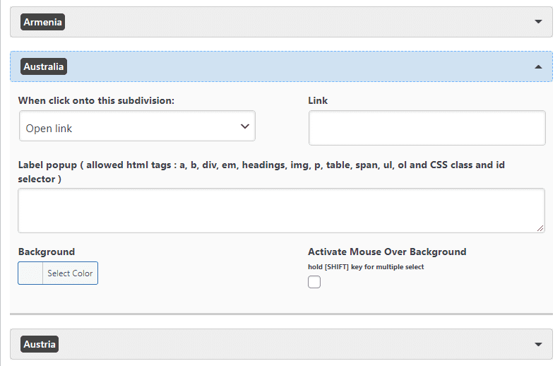
RVM lets you make a simple world map. Then, you can add a link, create a label popup, and change the background color for each country.
RVM is for you if…
- You want to create a simple map for your site.
- You have pages on different countries and want to be able to link to them from your map.
RVM Marker Pricing: Free | Learn More About RVM
3. Super Store Finder for WordPress
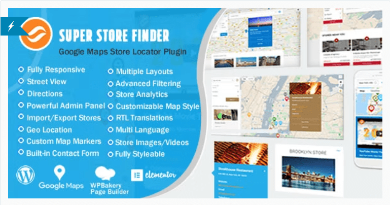
Super Store Finder for WordPress is a store locator plugin that integrates with the Google Maps API. It enables users to find your physical storefronts more easily. Additionally, it is fully responsive and offers various store locator layouts.
Key Features for Super Store Finder:
- Create unlimited store locations with custom labels and captions.
- Use an analytics tool to track your store views and clicks.
- Add a built-in contact form for each store.
- Use customizable region and country filters.
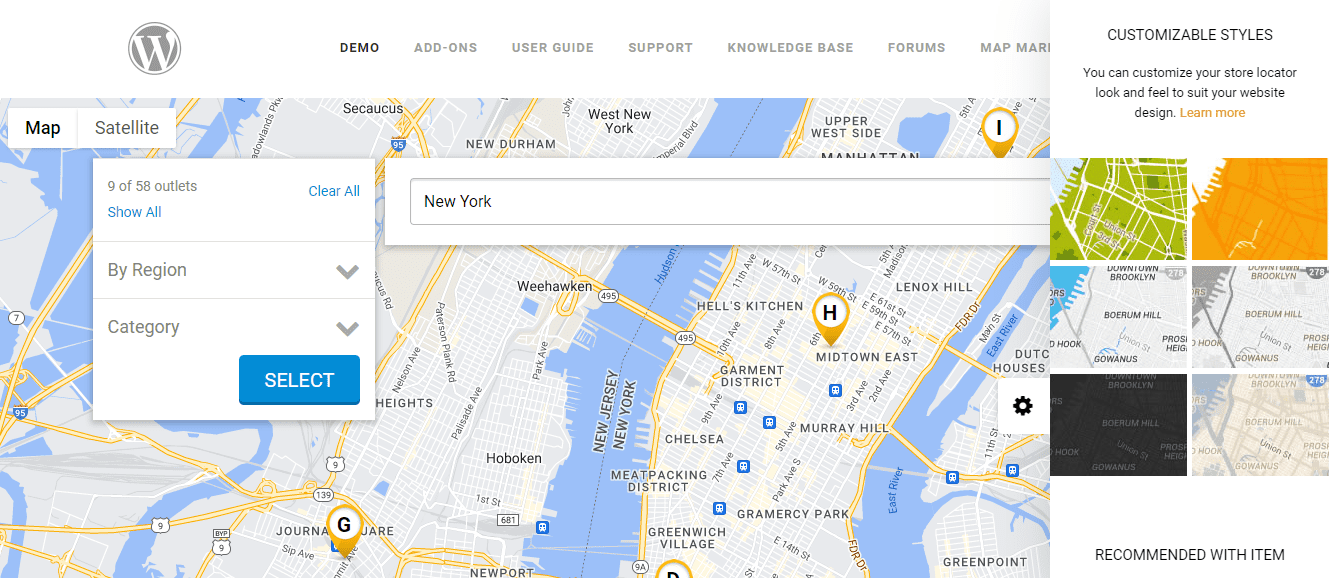
With this plugin, you can show all stores or a particular location. You can also display a collapsable panel on your map so users can navigate your site using categories, tags, and regions.
Super Store Finder is for you if…
- You have multiple brick-and-mortar stores.
- You want to make it easy for customers to find and contact your outlets.
Super Store Finder Pricing: $25 | Learn More About Super Store Finder
4. Progress Map
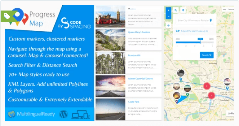
Progress Map is one of the best interactive map plugins for WordPress for displaying location-based listings. You can show your locations as markers on Google Maps or a carousel.
Key Features for Progress Map:
- Choose from over 70 map styles.
- Add a search filter and distance search.
- Create custom markers for your store.
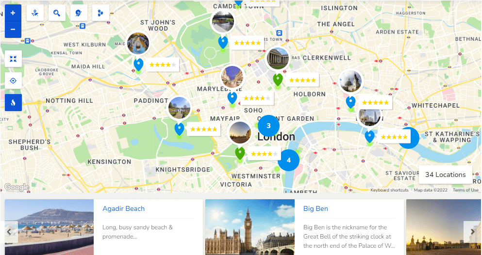
With Progress Map, you can add a carousel that displays an image and a short description of each location. When a user clicks on an item in the carousel, they will be directed to that location on the map.
Progress Map is for you if…
- You want to display job listings, hotels, restaurants, and more.
Progress Map Pricing: $59 | Learn More About Progress Map
5. MapSVG
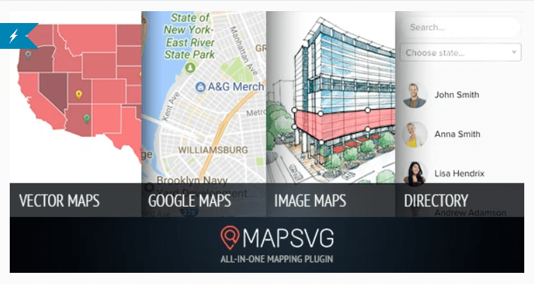
MapSVG enables you to create a range of interactive maps. For example, you can display an aerial view of your area, highlight your stores, and present data and statistics.
Key Features for MapSVG:
- Draw custom SVG files and use them with the plugin.
- Create different objects (e.g., stores, sales reps, data, etc.) with custom fields.
- Display a list of your objects with a search bar and filters.
- Set actions that should be performed when a user clicks on an object.
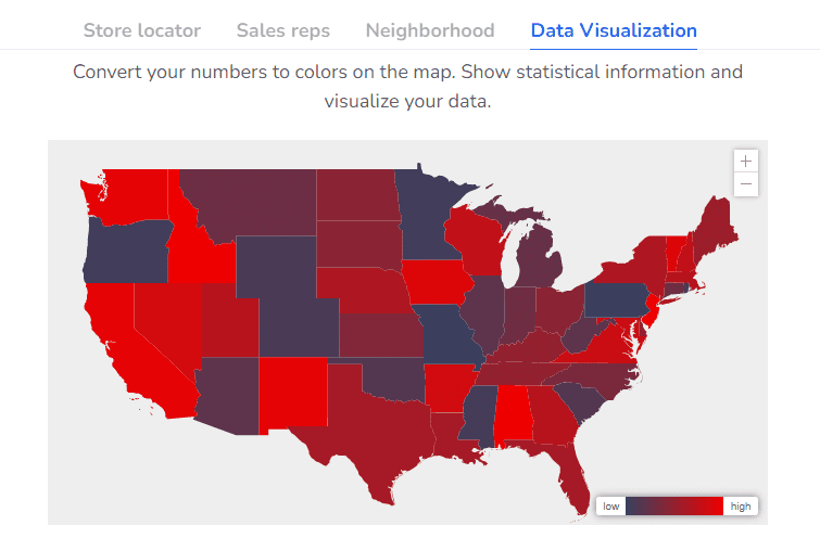
MapSVG makes it easy for users to navigate your map and understand essential data. You can show your content as markers, display popovers and tooltips, and provide additional details when users click on an object.
MapSVG is for you if…
- You want a user-friendly way to present data and information about different locations.
- You run an outdoor attraction and want to give users an immersive aerial view of your premises.
MapSVG Pricing: $49 | Learn More About MapSVG
6. WP Store Locator

WP Store Locator is an easy-to-use interactive map plugin that enables you to display an unlimited number of stores. Your visitors can filter the results by radius and view directions to your outlets.
Key Features for WP Store Locator:
- Provide additional information about each store, including email addresses and opening hours.
- Show driving directions and distances to each store.
- Display your maps in different languages.
- Keep track of the most popular locations that users search for.
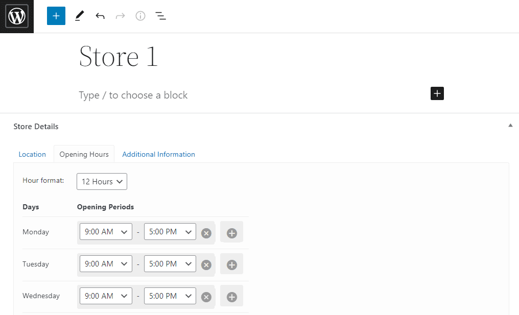
Once you install the plugin on your site, you can start adding stores to your map. For each shop, you can specify its exact location and opening hours. Furthermore, you can provide additional information like contact details and the website.
WP Store Locator is for you if…
- You want to make it easier for customers to find and travel to your physical stores.
WP Store Locator Pricing: Free | Learn More About WP Store Locator
The Divi Map Module
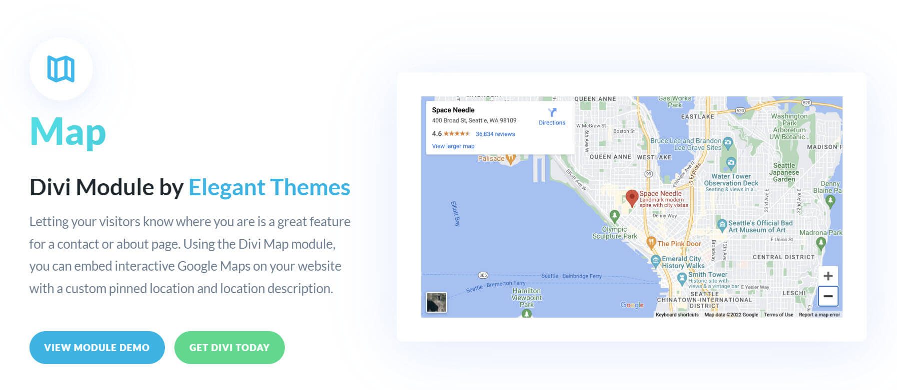
If you’re a Divi user, you can add a custom interactive map to your site without the need for an extra plugin. Thanks to our Divi Map Module, you can easily embed an interactive map anywhere on your page with clickable pins, popups, and multiple locations.
Key Features for the Divi Map Module:
- Add customizable pins with tootips to the map.
- Built-in design settings for customizing elements of the map.
- Supports draggable zoom, additional animation effect, and more.
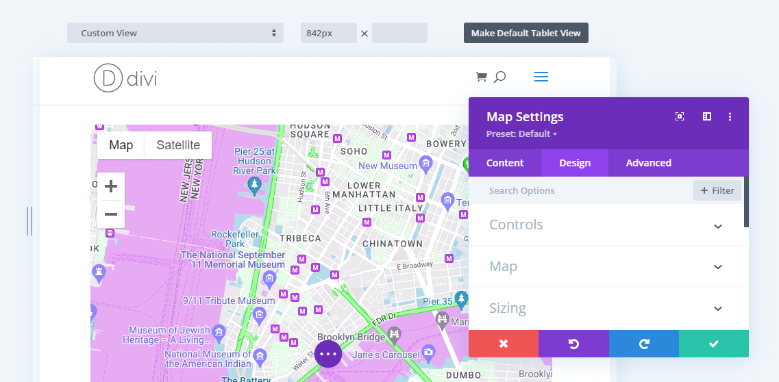
With our Divi Map Module, you can customize the design of your map elements with built-in options including color, map hue and saturation, and more.
The Divi Map Module is for you if…
- You’re a Divi user and want a built-in solution for designing interactive maps.
- You don’t want a bloated plugin.
Divi Pricing: $89 per year. | Learn More About the Divi Map Module.
Final Thoughts on Interactive Map Plugins
Adding interactive maps to your site can make your content more engaging and interesting. These maps can highlight landmarks, stores, hiking trails, and more.
If you want to create a simple vector map, you can use a plugin such as RVM or MapSVG. For more elaborate maps, you can opt for a tool like Progress Map and create a carousel of your listings. Meanwhile, we recommend a store locator such as Super Store Finder for WordPress if you run multiple outlets.
Do you have any questions about choosing the best interactive map plugin for WordPress? Let us know in the comments section below!
Keep reading the article at Elegant Themes Blog. The article was originally written by Will Morris on 2022-10-06 11:34:20.
The article was hand-picked and curated for you by the Editorial Team of WP Archives.

